Politics & Government
How Will Rising Sea Levels Affect Local Communities?
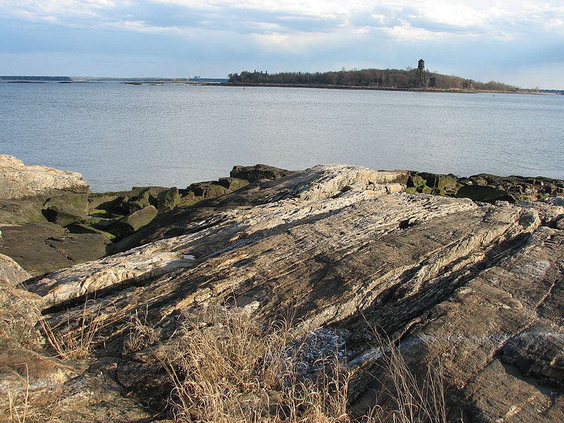
State officials predict that local waters will rise by as much as five feet by 2100. How will this affect towns and cities along the Sound Shore and Hudson River?
Larchmont is practically underwater.
Not the upscale Sound Shore community; this Larchmont is a middle-class neighborhood in Norfolk, VA that's surrounded by the Chesapeake Bay and the mouths of several rivers.
Much of the area is under constant threat of inundation, as the surrounding waters have risen by 14.5 inches since 1930—the highest relative increase in sea level of anywhere on the East Coast. A recent New York Times article called Larchmont "the front line" in the battle against rising waters and detailed the tribulations of local residents and the multi-million dollar projects that may or may not produce a solution.
But how far off is this headache for Westchester's Larchmont and other communities along the Sound and the Hudson River? What does it mean for residents? The potential consequences could affect local utilities, regional commuters, waterfront businesses and local property owners.
"It could happen next summer," said Kristin Marcell, a member of the State Department of Environmental Conservation's (DEC) Hudson River Estuary program, referring specifically to a once-in-a-generation storm that, coupled with rising waters, could wreak havoc on waterfront developments, including homes, roads, train tracks and recreation areas.
Debates over the cause and extent of climate change continue to rage around the world, but the jury is in on at least one issue: global sea levels are rising, due to higher average temperatures and melting ice caps.
New York Harbor has seen a 15-inch increase since 1860 and a 6-inch rise since 1960, according to the DEC, and the story is the same for the Long Island Sound, where consequences could be grave for the low-lying communities that make up the Sound's 600 miles of coastline.
A new report from the DEC's Sea Level Rise Task Force says the increase in the lower Hudson Valley could be as much as five inches in the next decade and 23 inches by 2100; but, in the case of a scenario called rapid ice melt, in which polar ice caps recede at an alarming rate, area waters could rise by as much as five feet by century's end.
"Sea level rise will continue to increase the risk to developed areas, future development and coastal habitats which are already highly vulnerable to powerful coastal storms," reads the report, which singles out Westchester, Rockland, the five boroughs and Long Island as the most vulnerable areas in the state.
"Many neighborhoods and their associated buildings, roads, and utilities will be directly affected, with the most vulnerable communities permanently inundated."
Most experts are hesitant to offer detailed hypotheses about what could happen, say, to the beach at Playland, the Mamaroneck Beach and Yacht Club or the Metro North train tracks on the Hudson River line. But a number of officials interviewed by Patch asserted that the effects of sea level are all too real and could displace residents, destroy parkland and habitats for wildlife and render train tracks, sewer systems and other infrastructure obsolete.
John Nolon, a Pace Law professor and an expert on land-use law, said that talking about a rising sea level is not as speculative as it may seem.
"We don't need to guess about a lot of this because communities have already been subjected to very significant floods in the last several years," said Nolon, a Tarrytown resident.
"We're not just sitting here, waiting for waters to increase suddenly by 22 or 55 inches; we're already seeing it."
The most pressing consequence of a significant rise in sea level, Nolon and other experts said, is so-called "storm surge" in which increasingly heavy rains trickle downhill into rivers and bays, causing flooding that is normally seen once every millennium to happen every few years. Floods that usually occur every 100 years will begin happening annually.
"Should the right storm track hit New York City, the Hudson estuary is vulnerable all the way up to the Federal Dam in Troy," said Marcell, the DEC official, who has been studying sea level rise for the last two years.
According to the DEC report, it's not just residents with waterfront views who would be at risk.
"An area far broader than the immediate coastline will witness flooding and erosion associated wtih increasingly powerful storms," the report says.
It continues, "the impacts will be potentially more dramatic because of the hidden impacts on the utilities and infrastructure systems upon which our modern society relies, [including] sewage, stormwater, fuel storage, communication and transportation. Public health will be further affected by vector-borne diseases and impacts to water supplies caused by changes in rainfall, heat and saltwater intrusion."
The group is scheduled to release its final report on the topic on Jan. 1.
Find out what's happening in Larchmont-Mamaroneckwith free, real-time updates from Patch.
After a freak storm in August 2007 shut down MTA trains and subways for several hours, the agency undertook a massive study of flood mitigation techniques. The resulting report found that the agency was wholly unprepared to deal with extensive flooding, and needed to implement a number of short- and long-term methods to stave off flooding. The problem is particularly acute in underground subway tunnels.
"The onset of global warming...represents a new and potentially dire challenge, for which the MTA system is largely unprepared," a 2009 report reads. "A number of climate changes have been measured in the MTA service area, and altered weather patterns are already impacting MTA infrastructure, primarily through increased storm activity and related flooding."
Find out what's happening in Larchmont-Mamaroneckwith free, real-time updates from Patch.
The report goes on to recommend that pumping systems be revamped to handle more water, and that entrances to some stations be raised, among other measures.
Compounding the situation is some disagreement over how to tackle the issue, and little consensus over who should be in charge of mitigation efforts. Should municipal and county officials be at the helm, or should the state and federal government, who have far greater resources than towns and villages, be spearheading the efforts? Or, perhaps, should private developers be given the responsibility?
Marcell noted that while many municipalities have taken the lead in implementing new land-use policies, "they want the state to take some action so they're not on their own, feeling like they can't implement policy."
Despite a number of studies and plenty of lip service, the state has done little in the way of digging in its heels and investing in sea level rise mitigation. The Sea Level Rise Task Force made a number of recommendations, including the adoption by the state of an official sea level rise projection.
Riverkeeper, an environmental advocacy group that focuses on the Hudson, recently endorsed the Task Force's recommendations, and suggested that priorities for local and state agencies should include the adoption of official sea level rise projections and new regulations for coastal development. The group also wants the state to study the potential impact of sea level rise on the 20 or so hazardous waste sites along the Hudson River south of Troy. Flooding, the group says, could wash out waste sites and contaminate the river and nearby communities.
"Land-use planning, permitting processes and public health policies rarely, if ever, address the public health implications of development in areas at high risk for flooding," wrote Riverkeeper's Danielle Schreiber.
"Post-storm inundation should trigger local and state governments to identify and address the less obvious problems, such as newly contaminated soil, riverbeds, coastal areas and inland hazardous waste sites. Gaps in understanding will only further prolong the devastating impacts after a storm surge."
Larchmont Mayor Josh Mandell said the village, like many of its counterparts throughout the region and the country, has taken steps to avoid consequences of climate change.
"We have incorporated new requirements into our building code that are concerned with the protection of our land" from flooding, as well as protection of existing developments from inundation, Mandell said.
Mega-projects such as dams and levees, he added, are prohibitively expensive and would require an almost unfathomable amount of cooperation from relevant local, county, state and federal authorities.
But Marcell placed more of the blame on the public's lack of urgency and enthusiasm than on any government entity.
"The public is just not on the same page as the people who are trying to figure out what we need to do next. If we don't have the public on board, then we are extremely vulnerable," she said.
"We had Hurricane Katrina [in 2005] and we're still in a similar place politically and in the public mind. There has not been progress of the scale that we need to keep our country safe."